
Qanats: Persia's Hidden Rivers
Gravity-fed tunnels that made deserts bloom. How ancient Iranians dug gently sloping tunnels to bring groundwater to the desert surface, a system still flowing after nearly 3,000 years.
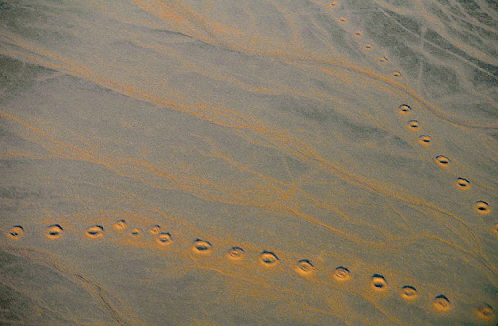
Lines of qanat shafts seen from the air near Isfahan, Iran: LBM1948, CC BY-SA 4.0
A river you cannot see
Fly over the dry plains of central Iran and you may spot something strange: long dotted lines of round craters marching across the desert like stitches. Each crater is the mouth of a well shaft, and every shaft drops down to the same buried tunnel. Together they form a qanat, one of the cleverest water systems people have ever built.
Most historians trace the qanat to ancient Iran in the early first millennium BCE, although some researchers argue for an origin in southeast Arabia. From there the idea spread in both directions, to Afghanistan, Oman, North Africa, China's Turpan oasis and eventually Spain, under a long list of local names such as karez, falaj and foggara.
How a qanat works
Builders started near the foot of a mountain, where groundwater sits closest to the surface. They dug a first deep well, often called the mother well, to find the water table. Then they tunneled outward toward the town or fields, keeping the floor of the tunnel on a slope so gentle that water would trickle along it without scouring the walls.
Because the land above falls away faster than the tunnel does, the two eventually meet, and the water steps out into daylight. No pump, no engine, no fuel: gravity does all the work. The vertical shafts along the route let diggers haul up soil, bring in air and later climb down to clear out silt. Running underground also keeps the water cool and protects it from the fierce evaporation of the desert sun.
Timing every drop
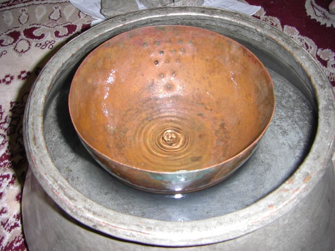
Water was precious, so sharing it fairly mattered. Farmers who held rights to a qanat received their flow in timed turns. In Iran this was measured with a simple water clock called a fenjaan: a small bowl with a hole in the bottom, floated in a basin until it filled and sank. Each sinking marked one unit of time, and a keeper counted the units to decide when one farmer's turn ended and the next began.
Qanats shaped whole towns. The coolest, cleanest water ran in the upper reaches, and gardens, bathhouses and storage cisterns called ab anbars were planned around the channel's path.
Still flowing after thousands of years
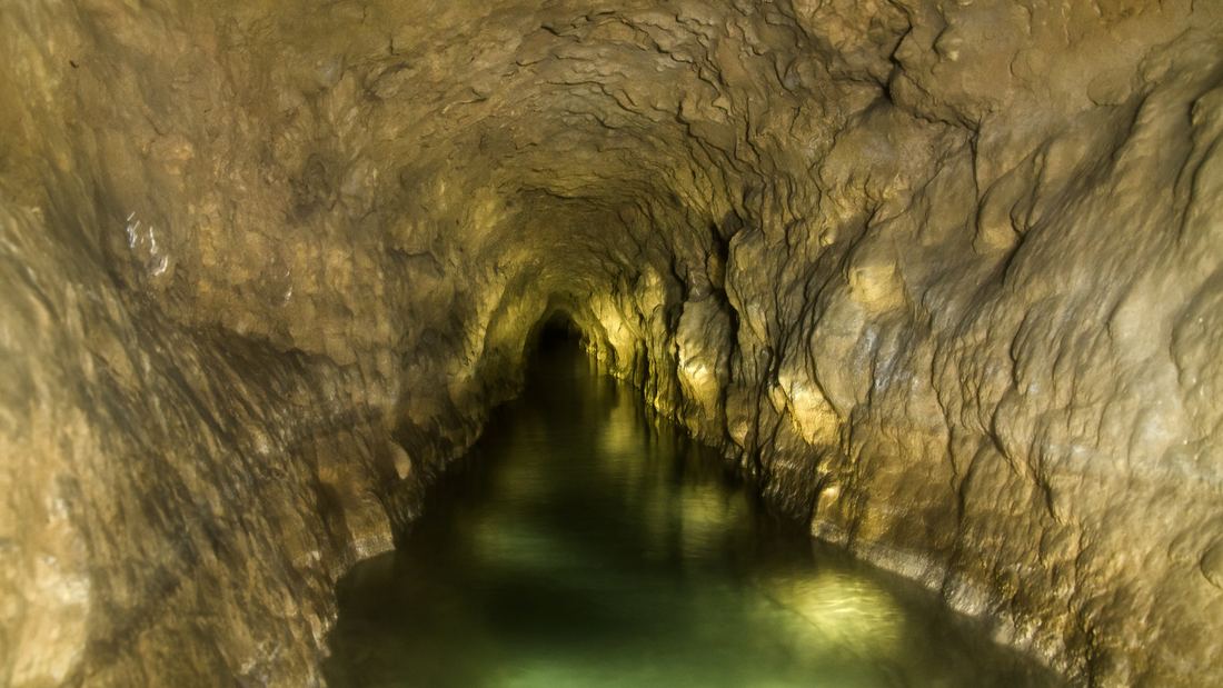
In 2016 UNESCO inscribed The Persian Qanat on the World Heritage List, protecting eleven representative systems in provinces such as Isfahan, Kerman and Khorasan. Among them is the Qasabeh qanat at Gonabad, one of the oldest and largest known, believed to have been built between about 700 and 500 BCE and still supplying water today.
Iran had an estimated 50,000 working qanats in the mid-20th century. Many have dried up as modern pumps lowered water tables, but tens of thousands still run. They are a reminder that some of the most sustainable engineering on Earth was worked out with shovels, lamps and a deep understanding of the land.
- Lines of qanat shafts seen from the air near Isfahan, Iran: LBM1948, CC BY-SA 4.0
- Inside the Qasabeh qanat of Gonabad, Iran: Tavasoli mohsen, CC BY-SA 4.0
- A traditional fenjaan water clock used to share qanat water at Gonabad: Maahmaah (persian tools), CC BY-SA 3.0
Text written by Ancient Visionary.
← Inca Roads, Rope Bridges and Knotted RecordsRoman Aqueducts: Rivers on Arches →
_02.jpg)

